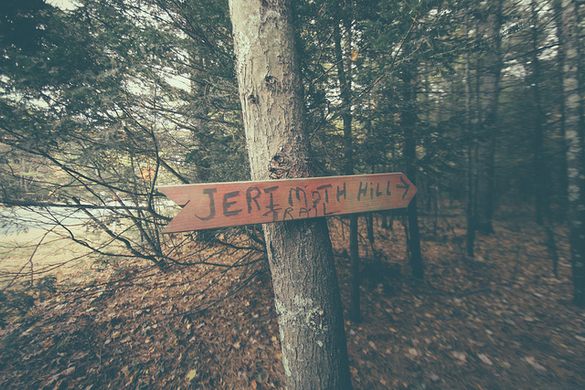
Jerimoth Hill

Mountain peak · Foster

Jerimoth Hill

Mountain peak · Foster

1

Foster, RI 02825

Photos

Jerimoth Hill by null
Jerimoth Hill by Basheer Tome on Flickr (Creative Commons)
Jerimoth Hill by Wikipedia (Creative Commons)
Jerimoth Hill by null

Highlights

Easy wooded trail to Rhode Island's highest point  

Placeholder
Placeholder

Foster, RI 02825 Get directions

Information

Static Map

Foster, RI 02825 Get directions

Features

Last updated

Aug 25, 2025

Powered By

You might also like

Terms of Use • Privacy Policy • Cookie Policy
 © 2025 Postcard Technologies, Inc.
@atlasobscura

The Highest Places in America

"Located in the backwoods of Rhode Island, the low lying Jerimoth Hill is the highest point in the state, but coming in at 45th among its fellow state high points, its not that impressive until you consider that it was nearly completely inaccessible for decades. Among “highpointers,” people who make a hobby of visiting the highest point in every state, Rhode Island’s tiny hill is not much of a challenge. Compared to the highest elevated point in the US, Alaska’s Denali Peak which sits at 20,320 feet above sea level, Jerimoth Hill is a measly 812 feet high. However in the early 1980’s the small hill, capped with a nondescript boulder, became the hardest peak to climb. This is thanks to one Henry Richardson who purchased the land that Jerimoth Hill rests on and immediately set up a perimeter. Richardson installed motion detectors and countless “No Trespassing” signs. It was said that if he caught explorers, highpointers, or other climbers on his land, the cranky landowner was said to scream at, threaten, and generally harass them off his land. In 1998 Richardson finally dropped his guard after pressure from the highpointing community, and eventually the land was sold to new owners who seem more than happy to welcome the climbers. The land has since been ceded to the State of Rhode Island, and scaling Jerimoth Hill is now almost literally a walk in the park." - ATLAS_OBSCURA

https://www.atlasobscura.com/lists/the-highest-places-in-america
View Postcard for Jerimoth Hill

Gage Hull

Google
Gnarliest hike of my life, do not recommend for the young, elderly, dogs, and anyone but those in peak physical condition. I’ve been hiking my entire life and almost didn’t make it out. Not for the weak or faint of heart.

Jon Hayes

Google
Highpoint #15 Rhode Island. Easy parking. Easy walk to the highpoint.

chris landadio

Google
Quick easy hike to bag the RI high point. Parking is best on the gravel across the street. Crossing the highway is easy but be careful. The trail is well marked. The survey markers are on either side of the trail about 100ft from the end. There are signs. The registry is at the end of the trail. Pretty close to the main highway, not far out of the way for a roadtrip down the coast

Emily Gettys

Google
Wasn't sure we were going to be able to complete this hike as we didn't have much mountaineering experience leading up to it, but I'm so glad we persevered and made it. And can I just say WOW. Truly the most magnificent and challenging summit I've ever reached. The terrain is ever changing throughout the hike as you trek through plains, cliffs, and scale glaciers. Even as an experienced hiker with a good fitness level, the trail and elevation gain were too much for me at times. Prepare to stop, take breaks when needed and go crush this beast! You won't regret it. Ice axe, crampons, and compass are a must as well as proper fuel and ample water/filter. Own your time on Jerimoth, a rescue is never guaranteed. All jokes aside, confusing to find but very easy high point to complete. My husband and I have completed a lot of high points but wanted to start our kids off with something our toddler could walk on his own. Probably not worth a trip unless you're in the area.

Eric Muse

Google
If you're into bagging peaks then you're in luck with Rhode Island's. There is parking and plenty of signage to get to the high point. Not much of a hike but the area is nice and wooded.

Missy B.

Google
Have done a lot of hiking in my day, but this was one for the books! Started at the opening of the trail and we made sure to do stretches, so we wouldn't hurt ourselves. You could feel a certain eeriness here.. Went off the trail a bit and found a pair of sneakers and a stick for hiking, but no hiker?? Perhaps they belonged to Jerimoth Brown, an early settler, it was named after, who died at 47 years old in 1830. Also it's been told, later on hikers could not access the site, because of a private property owner named Henry Richardson, who was nicknamed "The Madman of Jerimoth Hill". Apparently he would scare off hikers. He died in 2005. We found the trail and some geosurveys along the path, but then there were signs pointing in two different directions to the trail. We checked out the trail to the left and it came to another geosurvey and a path that seemed to be overrun with growth. Was someone or something trying to lead us off the trail? It had that "Blair Witch" feeling to it. We got back on the other trail after going around in circles what seemed like hours...🤔 We continued to follow and eventually came to almost a clearing and to the right was a rock with a metal box chained to a tree. I did not see any signs saying we were at the peak, as I've seen in other pics. I told my cool friend to stand back as I attempted to open the metal box. I was a bit worried it would blow up on me. But I opened it and there was a highpointers logbook, a mask that said 2020, some change, and bandaids. As this was happening, something spooked our mules and they ran off, which means we would have to carry our heavy packs or die in these woods. Our Sherpa was checking out the peak, and then he fell off! Me and my friend looked at each other like "what the heck just happened??" Then a blonde girl walked down the trail and my friend called out, "Is that our Sherpa??". She laughed and asked if we were high pointers. Then let us take pics and after we walked around she signed the log and disappeared. We checked out the area and there was some weird metal torture device, a wooden building with a metal container inside with a warning label, a building that looked as if it was a snack shack or souvenir place, but low and behold we did not get a bumper sticker or magnet saying "I climbed Jerimoth Hill and survived". Can't say that for the Sherpa..🤦‍♀️ We managed to make it out of the woods and saw the girl get in a truck with New Jersey plates on it. Was she a ghost, or someone who drove all the way from Jersey to climb 811 or 813 feet? Anyway treacherous. Find a sherpa that won't play around on the peak and mules that don't get spooked. As for the sneakers...were they Jerimoths or Henry's? That may be something we will never know!

Robert Sanders

Google
The high point in the state of Rhode Island. Parking is only allowed across the highway from the trail. We prepared tor a nice hike, complete with backpack and water. A few minutes later we were at the high point. After signing the book near the point, we hiked a little farther till we found private property signs and turned around. Never did open that backpack or water. Trail is nicely paved and covered with a canopy oh White Pine and Beech trees.

Ben M

Google
This is the tallest point in RI, clocking in a whopping ~812 feet along 8 feet of elevation. Despite the low elevation it has been known as one of the most difficult high points in the United States due to its history. But in 2011 that changed, and it's now easily accessible to the public and a nice path has been paved (literally and figuratively) allowing anyone to visit the "summit". The path is very well maintained and clearly marked, an easy walk that will take you no more than 5 minutes and that's if you're going a very slow pace. At the top, remains of the old observatory set up by the university can be found. Three old buildings, a lookout area, as well as a guest book to sign await you at the "top". If you're considering, it's a must. And take a moment to look up the history of this location to learn how special the ability to easily walk to this spot is.
google avatar

Emma G.

Yelp
There's definitely not too much to this one. I came by yesterday afternoon with my top-tier chum who literally went to the school of hospitality to knock off my 18th state high point on the way to Boston. Like most of the high points I've encountered, this one is also pretty much in the middle of absolute nowhere; this was my chum's first visit to Rhode Island, and it's safe to say it's not the area the state's tourism bureau promotes to prospective visitors; it's very rural and located in the extreme NW corner of the state. It was actually pretty easy/convenient to get to; we took 395 up from CT and then a quick five to 10-minute drive on 101 eastbound from Killingly, where we located a small sandy parking area on the lefthand side across the street from the trailhead. (We initially got distracted and thought the high point was on the parking area side of the street, but once you see five angry "No Trespassing" signs, it's pretty easy to notice and then fix your mistake.) Conditions could have been worse (it was dry save for a few random flurries), but it was VERY windy. I don't think it had anything to do with the comparatively high altitude - it's literally about 800 feet above sea level - but it added an element you typically associate with a "real" high point on top of a mountain with views and whatnot. The trail itself is a flat dirt path, so as long as it's not coated in snow there's really no reason you'd have issues traversing it. This isn't exactly a lipstick on a pig situation but there's not a lot needed here in terms of trail maintenance/markers. There's a pretty prominent sign next to the trailhead confirming the nearby location of the high point, and then consistent markers on the trees heading to the actual high point - they literally say Jerimoth Hill on them, so if you don't find this, it's really on you. A few of the little markers looked pretty beat up so my only constructive feedback is to possibly upgrade them before they become completely useless. I will say though that they could use an extra sign or indicator at the high point, which is a rock - it looked to us like there had been a recent rock cairn there to denote the spot but that it had since fallen down. The location is right by a few other informal trails (denoted with colored ribbons on trees) so we did a quick check on those to make sure we didn't have to keep going. But the easiest way to confirm you're in the right spot is to look for a prominent rock and an accompanying ammo box attached to a nearby tree to log your high point visit. Probably the least memorable high point I've done to date (Delaware is up there as well), but at least it's an easy one to quickly check off the list.
google avatar

Ben M.

Yelp
This is the tallest point in RI, clocking in a whopping ~812 feet along 8 feet of elevation. Despite the low elevation it has been known as one of the most difficult high points in the United States due to its history. But in 2011 that changed, and it's now easily accessible to the public and a nice path has been paved (literally and figuratively) allowing anyone to visit the "summit". The path is very well maintained and clearly marked, an easy walk that will take you no more than 5 minutes and that's if you're going a very slow pace. At the top, remains of the old observatory set up by the university can be found. Three old buildings, a lookout area, as well as a guest book to sign sit at the top. If you're considering, it's a must. And take a moment to look up the history of this location to learn how special the ability to easily walk to this spot is.