Katrina G.
Yelp
During a short first visit to Tahoe, we were looking for an easy, but somewhat long trail to see the lake. We wanted something that got us close to the lake, but also gave us views overlooking the vastness of the lake. Tahoe East Shore Trail hit all of those checkpoints for us!
We started the trail by Tunnel Creek Cafe and parked in one of the spots along the road. Spaces are pretty limited because it is just one row of diagonal parking spots down one side of the road, but we went early enough and during mid- November, so we found a spot without a problem. When we returned to our car, however, all spots were taken and people were parking on the street. When we went, they had parking meters installed, but a note on the meter stating that they were not yet charging for parking.
The trail starts with a 0.0 mile marker, as well as some information about the project to create the trail and the challenges they had to overcome.
During our first stretch of the trail--about a mile or so, you'll veer away from the lake and up a hill. We didn't find the hill to be too strenuous, but it is more than a small hill. At the top, you'll find several lookout points that overlook the lake before you descend. At the bottom of the hill, you'll cross under the road and pop out very close to the lake. You'll also find your first bathroom stop on your right, as well as several bike racks. From this point on, the remainder of the walk to Sand Harbor is essentially flat and near the lake. The whole trail is paved, with the exception of a few metal bridges. Along the way, you'll pass mile markers showing your progression on the trail. You'll also pass one more set of bathrooms, as well as bathrooms at Sand Harbor. On our trip, there was only one single occupancy bathroom open at Sand Harbor and it was not maintained with soap. We didn't try any of the other bathroom locations, but were disappointed to see this basic amenity closed off for the off-season.
Along the trail, you'll also see several marked turnoffs that have shoreline access or other notable spots. Taking these turnoffs generally takes you down wooden stairs or onto dirt paths. While we did not head to the shoreline, we did take the turnoff to the harbor overlook. We weaved our way along a dirt path for maybe 1/8 of a mile to a bench overlooking the harbor. Then we carried on until we hit Sand Harbor and then headed back.
The trail is pretty populated with walkers, bikers, dogs, etc., as well as many kids and parents with strollers, that sometimes made it hard to pass leisurely walkers in congested areas.
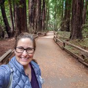
The views at any given point on the trail are phenomenal. You get to view the lake from up above, as well as from down close. You get a great sense of how large the lake is from up high, but can see just how blue the water is from up close. There are ample spots for photos along the trail, as well. I couldn't think of a better way to see the lake for the first time than to spend 5 miles alongside of it (2.5 miles to Sand Harbor, 2.5 miles back.)
At Sand Harbor, I ventured out onto the boat launch docks since we were in the off season. There is also an area with rocks along the water that provide a great view if you're daring enough to climb them, which I am not. You also have the option to continue through the trail for another half mile or so, but we stopped at this point and turned around.
I highly recommend the East Shore trail, which is new as of June 2019 for a phenomenal view and a somewhat easy family-friendly walk.