Lost Maples State Natural Area

State park · Bandera County

Lost Maples State Natural Area

State park · Bandera County

1

37221 RM 187, Vanderpool, TX 78885

Photos

Lost Maples State Natural Area by null

Highlights

Birds & wildlife, plus limestone canyons, plateaus & fall foliage along a river valley.  

Placeholder
Placeholder

37221 RM 187, Vanderpool, TX 78885 Get directions

tpwd.state.tx.us
@lostmaples

Information

Static Map

37221 RM 187, Vanderpool, TX 78885 Get directions

+1 830 966 3413
tpwd.state.tx.us
@lostmaples

Features

wheelchair accessible parking lot
wheelchair accessible entrance
parking private lot
crowd family friendly

Last updated

Mar 4, 2025

Powered By

You might also like

Terms of Use • Privacy Policy • Cookie Policy
 © 2025 Postcard Technologies, Inc.
@travelleisure

Two Eclipses Are Coming to North America in the Next Few Years

"Lost Maples State Natural Area is a site located in Texas, USA, where the annular solar eclipse on October 14, 2023 will be visible. Additionally, this location will experience a total solar eclipse six months later." - Travel + Leisure Editors

https://www.travelandleisure.com/trip-ideas/space-astronomy/when-is-the-next-eclipse-north-america
View Postcard for Lost Maples State Natural Area

Jeremy Lowe

Google
What an amazing place! We came to see color change, and were not disappointed. In Texas, color change in the fall is not guaranteed, so being in a place where reds, oranges, greens, browns, and etc can all be seen is monumental. The state park is very popular, so you will need to make your reservation well in advance of your visit. The trails are amazing - there are so many lookouts and scenic views. The terrain is mostly easy, but we did the eastern trail, which had a very sharp uphill and downhill elevation change. Bring water. Texas, at any time of the year, requires hydration. Be smart and bring more water than you think you will need. 1000% love this park and will return as often as possible!

Michael Jimenez

Google
The park was beautiful, the hike was strenuous but totally worth the hike. $6 per person to get in and I recommend going during the week if you can. The park packs up fast according to the ranger and if it's full, you won't be allowed in. You can make reservations if you choose to. The porta potty was clean too. I recommend checking it out sometime.

Erika Medina

Google
Bathrooms in this park are bad!! No restrooms at the welcome center, only port-o-johns that need service . Restrooms in the park had no soap and some stalls no paper :( the park was also very strict about the entry time The park is beautiful, fall colors were muted this year but I expect they will be 2x more glorious next year. Mother Nature never disappoints but the bathrooms certainly did.

Cynthia Reilly

Google
It's pretty beautiful, but there's not a lot of water to go for a dip. They do have many areas with ponds, but they're very murky and have a lot of moss. The restrooms are clean. There's no lights at night for you to see, so if you're camping, bring flashlights or whatever, so you ha e some type of light. I'd definitely go back to hike because it's beautiful. I wouldn't recommend this place for swimming because it doesn't look swimming friendly. Some girls told me that the water was pretty gross and they were yelling it was gross. Anyhow, it's beautiful, and I came September 1st, 2024. I will be back for sure.

Lisna Siahaan

Google
We love the park! Need reservation to get in, especially during peak season. We went during Thanksgiving week, and it was crowded. The foliage colors were on their best when we went. Beautiful scenery all around!

Shelby Scroggins

Google
Always beautiful here, no matter if the leaves are changing or not. The trails are so quiet, especially on the West trail. There are so many scenic views to find, tucked away in every corner of this park.

Jose Flores

Google
Great place for family fun, hiking, camping, and some light fishing! Would definitely recommend to TPWD to improve the day-use restrooms. Include a shower for those wanting a refresh after a good hike.

Brian Hayes

Google
This is one of my favorite places in Texas to hike. I came here again recently with my love as she was preparing to go hike the Grand Canyon rim to rim with her running group. We got a 1,000 foot elevation change during the course of our 9-mile hike. We will definitely be back!
google avatar

Wilnesa C.

Yelp
One of my coworkers recommended this place to me. He told me there was a "monkey rock" along the hike, so I had to see it for myself. He wasn't lying! There's actually a rock that resembles a monkey. The hike itself was decent, but finding this rock was like the icing on a cake. Definitely bring water and be prepared to take some cool pics!
google avatar

john g.

Yelp
It's a beautiful park with lot of different trees and wildlife. Pretty good hiking for all levels. We also took a stroll to visit the monkey rock. It's a rock that looks like a monkey. Kinda fun. Best time to visit is in the fall when leaves change colors. I certainly did not expect this type of terrain nor vegetation in this area. Cool place!
google avatar

Mark F.

Yelp
This is a "Bucket List" item that I have actually not tried, but God will get around to traveling to and experiencing firsthand myself some fall, once the price of fuel returns to more friendly levels; the photos of the rare in Texas maple trees are magnificent. and apparently there are trails and rather rustic camping opportunities among them; personally, and quite unfortunately, my personal life has been changed radically to a new rather sedentary state, because I became a quadrilateral amputee with significant hearing loss from the deadly disease meningoccemia that I contracted in 1995, in New Zealand, where I was a college lecturer in management-organizational behavior. I used to surf, snowboard, and camp-explore and live in harmony with the natural world that our creator, God Almighty provided all to respect and enjoy. Cheers, Mark C. Fearing, Ph.D. (ShredderV@aol.com).
google avatar

Sean M.

Yelp
So I actually used to be the the Texas state park ambassador for this park years ago. So I'm very familiar with it :) I adore this park. It's a 3 hr drive for me to get there, but I don't mind. The park is stunning. From the high cliffs to the low valleys, there's beauty at every turn. The reason I actually chose Lost Maples to be my park was because personally, it has everything I want in a park. Cliff side scenic views, low breezy valleys, gorgeous trees/foliage, water/streams etc. And who can say no to a rock that looks like a monkey?? Truly one of the most special and beautiful parks in Texas.
google avatar

Marshall M.

Yelp
This park is a fantastic hike and well worth your trouble... but before getting to far into this, let's get a couple caveats out of the way. 1. If you live in SATX proper, this is a bit of a drive for a day-hike. We're willing to go out of our way for a great hike, so it was worth it. We went early in the morning got in a great hike and caught a late lunch in Bandera on the way back. So it's totally doable. 2. This park is in the middle of nowhere. Zero cell service and the signs make it clear that the closest medical facility is the hospital in Kerrville which is like 50 minutes away. Not a deal breaker, but important to know (and plan for) up front. Now, that said, this is an awesome place to hike. So many great natural features, varied terrain, and fantastic overlooks and vistas. The hikes are challenging, but doable and you will be well rewarded for your efforts. Plus if you want a place to see fall colors in central Texas, this is it. We got here a little late in the year to see all the colors... but we still got to see a fair amount. This is a park that you will want to take your time in. There are so many spots where you will want to stop and just take it all in. Whether it's a natural spring bubbling into a pool, or an epic vista where you can see for miles. If you're a hiking camper, there are multiple walk in camp sites, which gives you even more time to really enjoy all the facets of this park. There's a reason everyone in the area says this is a must see.
google avatar

Carrie M.

Yelp
Did a three-day backpacking trip over Halloween weekend. There was great weather with warm days and cool nights. I was disappointed the leaves hadn't changed colour, but we checked the foliage reports beforehand, so we knew in advance. I did a trip here late November three years ago, and the foliage was beautiful. However, nights were very cold. The hike to the scenic overlook at the highest area of the park is a steep ascent but grants very pretty views. The primitive campsites were solid, and there was a good spread of composting toilets. We filtered water from the pond for drinking.
google avatar

Beatriz B.

Yelp
Bring your lunch, walking stick, water, good hiking shoes, fishing pole, camera; and don't forget puppy. The restrooms have a filtered water dispenser that I thought was super cool. Bring extra socks because you just might have to step through a creek in order to follow a trail. Definitely hydrate :)
google avatar

Ruthie B.

Yelp
What a pretty park! We were only able to hike the East Trail as there's still snow, ice and MUDDDD for days. It was about 6 miles rt. We slipped a couple times. I definitely recommend waterproof shoes and trekking poles. You will not have reception once you enter the park and won't have it until you're on higher grounds. I downloaded Alltrails map ahead of time. I look forward to visiting this park again in the fall.
google avatar

Cynthia V.

Yelp
Want to see Fall in Texas? Then you have to check out LMSP. Beautiful trees abound with vibrant reds, oranges, and yellows sprinkled in your typical hill country greenery. There is a large network of trails here with varying degrees of difficulty - of course the large vista views come from hiking up the steep hill, but if you are in for just a general nature walk and leaf peeping, you get all of that from the flat, easy East-West trail. Pack a picnic! You are definitely secluded in this part of the hill country so it is not easy to just leave for a snack or meal. Plus, there is a beautiful picnic area with tables and grills near one of the trailheads that you will be kicking yourself if you pass up - who doesn't love a relaxing outdoor picnic in the trees? Day pass reservations were required when we went and we booked ours a month in advance because we heard they sold out fast, so keep an eye on that if you are going during peak season (Fall and weekends).
google avatar

Jake H.

Yelp
Lost Maples is a great state park to visit. The trails on the east and west have challenging pieces. The West Trail is much quieter and a longer hike. I saw more people on the East Trail and it was easier to follow the path. I got off the path on the West Trail a few times as it looked like a path but ended up turning into a section that was not maintained, thus not the trail. The West Trail was more shaded but the downside to being the first on the trail in the morning was hitting all the spider webs. Bring water and lots of it, especially in the Texas summer heat!! There is a water station to fill up water bottles at the day area where you can park, right in front of the restrooms. If you want to camp here, book your trip earlier, even for day trips. You need a reservation to get in and both days I hiked there was a sign that said all day trip spots had been filled. Lost Maples is a tough hike in certain areas and when the sign says steep, they mean it. Big upward climb- you stay on your feet and don't need your hands to climb it but your thighs will be burning with the huge upward climb. Fall would be beautiful with the leaves changing colors but probably really busy then too. Also, hard to predict when the colors will hit, some years it's December.
google avatar

Patty C.

Yelp
Spent three nights camping here during Thanksgiving Break, and my expectations were exceeded! People flock to this park this time of year for the fall foliage, especially from the Big Tooth Maples that are almost unique to this region. Even though we came on a weak year in terms of fall foliage, I was still delighted by the hues of red, orange, and yellow clinging to the tree branches. This park is known for their hiking trails which include somewhat steep inclines and descents. They are definitely doable with just a good pair of sneakers and having average fitness, but I VERY highly advise wearing a good pair of hiking boots and bringing along a walking stick or trekking poles for a much better time! We had at least six people that passed us admiring our poles, one even jokingly asking how much for one. The 400 feet of incline and 400 feet of descent is no joke. We took the East-West trail and looped through to the East Trail. I recommend doing it in this in this order if you plan on doing both and would like less crowds, as you will be going against the flow. There are sections of the trail near the Maple Trails that goes over steams, and the loose rocks mixed with varying water levels may cause wet feet (not a problem with hiking boots). Monkey Rock was pretty cool as was the Grotto. I may attempt the West trail next visit, but we didn't have time for it as we spent time at nearby Garner State Park as well. Camping is in high demand here this time of the year. I booked my water and electric spot eleven months in advanced. The campers here are very courteous and follow the park rules, probably because of the limited camping spots in the camping loop. Only two spots on the loop offer great privacy, but it wasn't too bad. Primitively camping also seemed popular as an option. The restrooms were clean due to less people using them. Most of the campers in the loop were RVers. Will definitely be returning to this beautiful park!
google avatar

Steve A.

Yelp
Just a quick update to my previous review since it's been a few years. I ran the East, West, & West Loop trails today for a total of about 10 miles with about 1000 ft of vert--not too bad for the TX hill country. It was a tough, fun run. The trails are super technical both on the ascents & descents which make it difficult to run: lots of loose rocks & roots. It makes for a challenging trail run. I suspect it will be equally rewarding for hikers. Both the East & West trails are a little over 3 miles while the West Loop is two and change. From my perspective, I thought the East Trail had the best views while the West Trail had the most runable terrain. The tops of all three hills had great runable sections but they were way too short. The West Trail Loop was great. There are several primitive campsites along the all the main trails that campers can hike to which looked very tempting. Protip: If you're just coming in for the day, it's $6. If you look at the map, park in the first parking lot on the *left* because that's where the East Trail dead ends. It'll save you a little walk (when you're tired) as opposed to parking in the larger area (with the rest room) where the East trail begins--assuming you choose a counter-clockwise route. Bring lots of water.
google avatar

Jeff U.

Yelp
Loved our time The 5 mile hike was a surprise Bet we finished it Saw lizards Tarantulas Fish We spent 20 minutes skipping rocks on water...was A great afternoon Rested Hiked Rested Breathed hard Cursed the map and hiked some more Whole family had fun!!! You need to try it out
google avatar

Monique H.

Yelp
Five stars for the amazing Fall foliage! Lost Maples didn't disappoint. I'm so glad I got a reservation in November. Did you know there is a Fall foliage report for Lost Maples? Google it! As of the date of this review, highway 337 from Medina to Vanderpool is closed to repair the Mill Creek Bridge. You'll need to detour! Watch for signs but also map it out because the signs weren't obvious in some places. I, like many this year, have ventured out of the Austin area to search for new trails to explore. My friend and I drove from Austin and back in one day. It's a bit of a trek but worth it. I'd recommend camping or staying overnight at a local B&B if you have the time. You can hike, fish, and swim here. The park area is well maintained with bathrooms, signage, areas for recreation. The trails are challenging and I'd recommend wearing hiking boots since there is rocky terrain and sometimes you're passing through some wet areas of the Sabinal River (depending on the trail). The trails have some tree shade but many parts are not so wear a hat and sunscreen. My friend and I got about 6 miles of hiking in. The map they provide at the entrance is similar to other state parks, easy to read and shows all the trails available. I also found several trail reviews on AllTrails. I'll definitely be back again!
google avatar

Brent L.

Yelp
Absosmurfly beautiful and well maintained! The trails names are a bit confusing for a first-time visitor though. I recommend the East Trail, Maple Trail, and the East-West Trail, not to be confused with the West Trail (see what I mean?). Take a look at my uploaded photo for the route we took. It elevated gradually from a low of 1878 feet above sea level to 2258 feet above sea level. The route takes you to the top of a very high hill and has some rugged and steep spots on it. Nothing like rock climbing, etc. but might be a bit too much for pets, etc. Total length of the loop is about 4-5 miles. Bathrooms - there are three natural composting bathrooms on the trails - permanent building structures - not port-a-potties but they do not have running water. Running water bathrooms are located at the day use area and the camping area near the front of the park. According to the map, there is a bathroom with running water at the entrance/pay station but they have it locked and they have port-a-potties instead. The entrance/pay station didn't have any drinks or water when we visited, so make sure you bring your own. The only thing they had was stuff for s'mores. This park has 8 primitive camping areas (including one on top of the big hill on the East Trail), 30 camping spots for tents, campers, RV's that have FULL RV hookups, water, electricity, etc. A very nice day use area that includes picnic tables and BBQ grills. Many of them are covered. Absolutely no cell coverage (at least not my carrier) in the entire park and really not anything between the town of Medina and the park entrance. If you are relying on Google Maps to get you there and back, download an "off-line" Google Map before you go. Free Wi-Fi at the entrance/pay station though.
google avatar

Christian R.

Yelp
Beautiful fall colors, well-paved trails, and amazing scenic views made our trip out to Lost Maples State Park so perfect. We made a reservation one month in advance and we're glad we did--the park was at "full capacity" on a Tuesday. We did see some wildlife here and there. Also, for anyone worried about COVID, although the park was "full," it was big enough to keep good distance along the hike. Definitely recommend checking this beautiful park out. We will be back for sure!!
google avatar

Toni G.

Yelp
Gorgeous hike through the scenic hill country. The drive was equally scenic. We tried to beat the sunset as we didn't want to get lost in the dark!!
google avatar

Adrianna C.

Yelp
Very cool place. We didn't do tons of hiking, so I can't review all the trails, but for the little hiking we did, it was really beautiful. We went on a Friday afternoon so luckily it wasn't too busy. We just walked on I think maple trail and did a small loop. We would have liked to camp but didn't realize that their only tent camping options are a 1-3 mile hike, so you have to backpack all your gear in. We don't really have the gear for that sadly, but hopefully soon so we can come back! Although we did see some people hauling stuff in that clearly was not backpacking gear, honestly only 1 mile isn't that bad to carry stuff in. Certainly try to come on a week day to avoid the crowds!
google avatar

Crystal H.

Yelp
I arrived at 9:40 on Saturday morning to a line out of the park. Thankfully we made it in before they shut it down. It was 10:30 by the time we paid and got to the trail. Be sure to factor this into your time when planning a hike and arrive before 10am. We did the East Trail (I think). It would be nice if they had a few more trail signs. I intended on doing the west trail but never saw the sign for it. I'm glad I didn't though because the East trail kicked my butt. This trail was moderately challenging the majority of the way but did have about 2 miles of intense challenge. Even so, there were people of all ages on this trail from small children to senior adults who were putting my young butt to shame. The leaves had some color but it was beautiful regardless and the weather was spectacular!
google avatar

Ashley C.

Yelp
Lost Maples State Natural Area is located approximately an hour southwest of Kerrville, TX. This park is located along the Sabinal River and encompasses the fork to Can Creek. The terrain is rocky with elevation changes depending on which trail you choose to take. Most of this park is a fairly easy hike, especially along the rivers and creeks. There are options for the more experienced or willing hiker that pay off with spectacular views. I visited during the winter, when the leaves of the maples have fallen already. This park hosts many people during the fall when the trees change colors, and is fairly quiet during their off season. Despite the fact that the main attraction had already passed, this park is beautiful. It is well worth a trip for a camper or a hiker. If you are someone who is not interested in hiking, fall may be the best time for you to visit. This park offers little other than a day use area to those who would not like to camp or hike. Camping here is not very private, as most TPWD campsites are. The campsites are one next to another, but do provide a bit of space between each site. I highly recommend making a reservation and check out which sites are taken. Choose one away from others if possible. You might be tempted to reserve a spot next to the river; if it's not private enough for you, don't bother. The view of the river isn't great from the campsites. The bathrooms here are CLEAN and masks are worn inside. 10/10 would camp again! Cats will probably come visit you in the campsite, so keep that in mind if you have dogs who may be upset at the sight of them. They are friendly.
google avatar

Whitney A.

Yelp
My mom and I had a blast hiking here! It's much smaller than the neighboring Garner State Park without much to do other than take a stroll, but we loved how easy and gorgeous the hikes were with fun streams to hopscotch across and even bathrooms along the way. We hiked the east trail to monkey rock which was very well maintained and easy to follow with beautiful views. Very doable for families and kids, and I would definitely come back just to see monkey rock!! It was awesome. We continued with the East trail, not sure what to expect. I nearly gave up 3/4 of the way up because people were coming down and saying there was no scenic overlook, but we persevered and I was actually so surprised. The trail leads you to the crest of a hill, and you walk across the top of it for half a mile while able to see gorgeous views into the valley. Very worth it!! I'm glad we ascended from the east because the west descent was a lot rockier and had less defined steps. We were tired from the 4 mile hike, otherwise I would've loved to see the west trail too. We went the weekend of November 6 and only a few of the trees were beginning to yellow, which was kind of a bummer, but it was still pretty and relaxing. Lots of dogs were out and about, and everyone was very friendly. Also the gift shop was very nice. This is a must-do if you're in the area!
google avatar

Sara S.

Yelp
Gorgeous park for a day hike through hill country. We will definitely be back... I came on a Sunday arriving at 10:30 expecting the park to be full, but as it turned out the park was mostly empty. Maybe it was the overcast, cooler weather. The cost is $6 per person. Dogs get free admission. We parked in the "overflow" lot as it was closer to the trails we wanted to try. We chose the East-West trail with the intention to get onto the West trail, all in around a 4.5 mile round trip. A park ranger stopped to chat and let us know that he frequently has to give dogs rides out of the park due to wearing down their pads. The gravel is quite rough on tender paws that are accustomed to the couch life... so after reaching the Spring attraction on the West trail, we got concerned about our small dogs' paws and decided to turn back. So, it was a 3.5 mike hike and we will leave the spoiled pups at home next time. A bigger dog would probably be fine. What I love about Lost Maples is that there are a lot of overlooks and benches along the way. We really enjoyed taking our time and enjoying the riverfront and springs along the trail. I am glad I wore waterproof hiking boots. Some rocks are loose and slippery and there are many water crossings. We did try to go to Utopia on our way back to San Antonio for lunch but could not find any dog friendly restaurants, so that was a bummer, just FYI. Maybe there are some around that I couldn't find.
google avatar

Gabriel D.

Yelp
Call Ahead! Drove 2 hours from east of San Antonio to find the park closed - and nothing was posted on their website. Update May 2020: Went back after getting a reservation - it's breathtaking. Very limited shopping within 30 minutes, so bring all you need!
google avatar

Erica C.

Yelp
Great hiking spot that is dog friendly! Make sure to pack your water bottles for both you and your pup though it gets hot !!
google avatar

Paige M.

Yelp
We loved Lost Maples State Park and we didn't even visit in the well known fall season. We didn't know quite what to expect going in off season or if it would be worth our visit, we LOVED it. There are not a ton of camp sites for RVs but we enjoyed that because it was more quaint and quiet. We hiked the trails and they were gorgeous surrounding by Maple Trees and the lookouts were stunning. The weather was perfect while we visited and we even got to visit the Lost Maples WInery which was right up the road and totally worth your visit!
google avatar

Jeremy S.

Yelp
I really love Texas state parks, but didn't quite love Lost Maples. Maybe it's because I'm from the Midwest, where gorgeous autumn views are an everyday fact of life in October and November, and no one feels compelled to travel for them. Maybe the blustery and overcast day combined with the long wait at check-in didn't put me in the right frame of mind. Who knows? (To the ranger station's credit, they do sell affordable marshmallows and cool walking sticks.) In any case, I'm happy to check Lost Maples off the list, but probably wouldn't make the three-hour drive from Austin to do it again, especially not with great parks like Inks Lake, Pedernales Falls, and Enchanted Rock significantly closer. So, did a November trip hoping to see some changing leaves. Oddly, the best views of these were on the drive to the park rather than the park itself, so I felt a little underwhelmed. The water and electric campsites are cheap and well-maintained, but also on top of one another, so be prepared to overhear your neighbor's conversations. If we came back, we'd probably go for the primitive areas, as I wasn't a huge fan of the spacing. There are nice picnic tables with awnings in case of rain and standard campfire pits. The ground is perfectly amenable to setting up tents. The two walking trails we did (the East-West and the Maple) offered some nice views of the surrounding hillsides and foliage and are, as advertised, suitable for most mobility levels. Being peak season for the park, the trails were a bit congested, but not unpleasantly so. Unfortunately, the walking trail areas are separated significantly from one another, with no interconnecting foot routes. We walked from the camping area to them, but that mainly involves walking along the side of the road and pulling your dogs out of the way of cars. Driving from one lot to the next is recommended. So, maybe I missed the better trails I'm reading about in some of the other reviews. In any case, there's clearly enough here to justify a day trip if you live nearby, but we'll likely call Lost Maples one-and-done.
google avatar

Kay J.

Yelp
Oh my goodness! We booked a day pass to Lost Maples last weekend and it was the best day ever! We started with the East trail - it has the most incredible views! There are a few spots with a pretty rigorous incline so it might be difficult for those with little endurance. I honestly hurt a bit after making it to the top but it was so worth the views! After hiking about 3.5 miles, we came across a fork in the trail... either turn left and hike one more mile to the exit or turn right to hike the West trail for another 3.5 miles ... hmmm, what to do? We decided to accept the challenge and take the long way back. I'm so happy we did because the West trail is absolutely beautiful! It's definitely more dense in the woods and offers such beautiful photo ops. We enjoyed both trails equally for different reasons. East has more panoramic views from a high elevation and West feels a bit more adventurous. We headed back to our car and got our cooler, propane grill, and food. We then found the most beautiful private picnic area and enjoyed a great lunch while resting our joints. A+ day!!
google avatar

Jim C.

Yelp
The park itself was beautiful even though the color was not as brilliant as last year. The overcast sky was a nice change, especially as it seemed to have discouraged a lot of the visitors - there was no huge line of cars stretching for miles outside the park, unlike last year. The surrounding country is also pretty - the northern drive between Lost Maples and Garner state park is especially hilly and scenic. TPWD publishes a foliage report you can read to check up on the colors before you go: http://www.tpwd.state.tx.us/spdest/findadest/parks/lost_maples/foliage.phtml Some more pictures are here: http://www.flickr.com/photos/jim_chou/sets/72157621571509507/
google avatar

Isabel B.

Yelp
This park has a little of everything. You can hike , swim , fish and camp. Dog friendly (on a leash) and offers bags for pet waste pickup. Trails are cleared and easy to hike. Many trails go through streams so make sure you were proper shoes and come prepared for some wet feet. They also have camp sites which we will try next time we come out. The rangers are very friendly and helpful. The facilities are clean but make sure you go before your hike. They do have restrooms out in the trail but they have a tank and not the flush type of facility. There are many hills surrounding the trails which makes the walks very interesting and relaxing. Overall this is a super nice park with many options for adventure.
google avatar

Elisa M.

Yelp
Such an amazing time spent here during November. Would highly recommend to check this place out. There is so much to see and I loved how there was so many streams with such clear water. The hike was at times steep so make sure to come prepared with plenty of water as well as maybe snacks. The views were amazing since the foliage was high and the trees were changing colors. The people working here are not the friendliest but the views of the park made up for it.
google avatar

K S.

Yelp
Beautiful place but wish there were more places to camp! So so so many people there that you had to purchase your ticket ahead of time to get in.
google avatar

Allyson T.

Yelp
Another fabulous place in Texas near the beautiful Frio river! I have spent many autumns photographing for gorgeous colors of the trees there is a fresh pond that empties into a clear stream and I found some hidden waterfalls off the beaten path
google avatar

Adam G.

Yelp
Pretty place to visit. Good trails. Lots of pretty nature. It's a good place for a short hike. Just a couple hours is enough to get around. Definitely recommended.

Austin T.

Yelp
The park itself is nice but it's one of the least well kept park in Texas, and we hiked 40+ all over Texas. They have one bathroom area for the main park (in addition to the portable potty at the Headquarter) and it's not clean, out of paper and out of soap. The trails are not well kept with several parts of the trails are under water which are not safe for hikers. They could have done a better job keeping the park safer and cleaner for visitors.
google avatar

Annie S.

Yelp
The security is a bit grumpy and seems flustered but I assume that's because we came during a busy season. There's so much to see, but there is a lot of hiking!! This place is breath taking and beautiful, there is two hidden small waterfalls as you go hiking up. Take your best shoes, a lot of water, camel back. Trust me it gets rocky up there (Ha). Lots of stability needed, watch for the loose rocks and don't be afraid to take breaks. Worth the hike, and it's fun. Once I got to the top we played Marco, polo with the people at the bottom. Lots of sights to see, hold your nose once you pass Clovis? The compost potty.
google avatar

Shaz M.

Yelp
One of the best scenic views of any state park I have been yo. This place has almost everything you would look for in a state park. Now that is short of fishing and game. Wear comfortable hiking shoes. You will need them. On top of different camp sites, this place also has different hiking trails based on physical condition and skills. The 5 mile ones are not for beginners and have many steep climb and drops so be careful and don't try to over exert yourself. It's basically all rock trails so again good shoes are a must. I made the mistake of forgetting them at home and regretted it 4 hours later. However take a few friends and behold the breathtaking view. P.s don't miss the monkey rock
google avatar

Ashley S.

Yelp
This park opened in 1979 and it is GORGEOUS. And the best times to go are in October and November, hands down. That's when you want to go and see the fall foliage. This is the main reason you want to go. They even have a weekly updated fall foliage report from October to November on the park website. It is helpful when you are trying to plan to go and see the most changes in the colors of leaves that fall. COST: It's $5-$6 for adults and free for children under 12. FUN: Picnicking, camping, backpacking, sightseeing, hiking, photography, bird watching, fishing, swimming and being one with nature :-) TIME: You can easily hike through the entire place in 4hours, and that's taking your time. LOCATION: About 5 miles from the nearest town of Vanderpool, TX. Utopia and Bandera are not far from Lost Maples. Here, it is highly suggested you stay on the designated trails (and of course we didn't). There are many natural hazards due to steep terrain and rock climbing is not suggested. It is very shaded, family friendly, and no one will stare at you like a weirdo because you are taking pictures of red or green leaves, because everyone is doing it! There are shack looking port-a-potties without toilet paper (BYOTP highly recommended) throughout the park, and they are located on the map that is given when you enter the park. There are two trails and each one is about 5 miles, and they reconvene once you get to the fabulous "mountain." This was the only fairly difficult part of the hike, because you're literally walking up a huge, steep, mountain/hill. But it's worth is and it's just about one of the prettiest views. The highest elevation in the park is 2,200. It's about 2.5-3 hours from Austin, and more if you get lost on those tiny, winding backroads. This is a great day trip to take from Austin. We rented a room in Boerne which is about 30 minutes from LM and then hung out there that night after being at the park all day. This needs to be an annual trip!
google avatar

Mike G.

Yelp
My 666th review, woot! Few tips for those who are coming to see the fall foliage: 1) Sunday is better than Saturday, the ranger said Saturday was packed with people 2) Get here early during busy season. We go there at 9 and there were plenty parking spaces. By the time we finished around 1PM, people are circling around the parking lot 3) If you are doing the hike on East or West trail, wear hiking shoes, the terrain is pretty rugged, with hills, loose rocks and small creek/rivers 4) There are more colors on the East-West Trail (1Mile) than the Maple Trail (.35M). I was hoping for more colorful park (I lived in OH for 5 year), but this is pretty good for Texas Overall, great park to hike, next time I will try the West and West Loop Trail.
google avatar

Whitney K.

Yelp
Beautiful. This place is so peaceful. If you're up for a steep hike, you'll definitely get amazing views in return. Went during November and the weather was nice and park wasn't crowded.
google avatar

Riley W.

Yelp
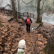
We did a day's hiking and camped over night in a primitive campsite in some of the worst wind I have ever experienced in 28 years of camping. The trails are a little rough in some areas, I'm not one to need a 12ft wide path the whole time, but there were some genuine moments of "which way are we supposed to go" while doing the two loops. Also, the constant river crossings on a damp day started to become both tiresome and dangerous as the stones got slippy. A little human intervention of build a safer option wouldn't go astray. As for cooking, we were firmly told that we couldn't use anything that "made ash". So you'll be limited to gas only stoves, which while they work fine I do have something of a philosophical issue with. The camping areas were littered with ground debris which made setting up camp longer than it needed to be. People using hobo stoves, or the increasingly popular Solo Stove could be using this material to fuel fires for cooking and warmth, which would reduce plant and tree disease in the area, as well as keep the campsites readily usable for the next people rolling through. I'm not suggesting people get their machetes out and start hacking down plants and trees, but the attitude of "all fire is bad and goes against Leave No Trace" is misguided and wrong. We are all part of the ecosystem, to suggest we should not be allowed to interact with it beyond looking at it is simply unrealistic. Yes not everyone was a scout, yes not everyone has grown up camping and spending time living in the outdoors, however education - not limitation is the key here. In a similar vein, I asked about making tent stakes from fallen branches, again I was given a firm "no". There is no logical reason for this. They will still degrade just as they would without a couple of notches carved into them, and I could have left them behind for the next campers who might need them. So, I was only able to stake out my rainfly in 2 of the 6 locations. 
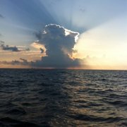
There was plenty of flowing water, though, few places to collect from that didn't involve getting face down in the dirt and sticking your arm out. However if you have a Sawyer water filter you'll never be thirsty at the Lost Maples! In the end, it's a solid "eh it was ok" experience. National Parks are turning into a "strip club" experience. Look but don't touch, and you'll have to spend a lot of money to be there for more than a few hours - hiking pack, ultralight tent, light sleeping bags, sleeping pad, ultralight gas stove and cooking pots and utensils - it all adds up to about $500 per person. I'm not suggesting everyone should be able to live in the park with just a knife, fire steel and a tarp for shelter, but there is a balance that could, and needs to be achieved. I hope the National Parks move towards education soon, before the only people visiting them are doing it from a drone with a 360° camera that doesn't rustle the leaves too much.
google avatar

Steve V.

Yelp
We came here to see the fall foliage on a Sunday to avoid the crowds. I think that strategy worked. It wasn't nearly as crowded as we expected. We parked and to get our ticket and then continued to the main lot where the trail heads are a mile in. Our parking spot wasn't bad. There is an open park area and bathrooms there, which makes it a good homebase. We chose to due the east rail even though my wife was pregnant and we had a 2 year old with us. Luckily, we had a carrier backpack and I was able to carry my kid most of the way. There are some steep inclines, but as long as you take your time, it wasn't too bad. The trail is wide so you never feel crowded. We did all fo the off shoots and enjoyed lunch at the overlook, which was nothing special. There were lots of people taking many pictures professionally and the colors were good, not great. Monkey Rock was a hit and I would come here again, wish I lived closer.
google avatar

Micaela R.

Yelp
Worth the two hour drive. What a beautiful, beautiful park. Very well labeled despite the trails that might be a little rougher. I appreciate the random scattered bathrooms, all indicated on the map. Beautiful views, lots of shade and green, and best yet, the changing of the leaves in the fall. If you haven't purchased a state park pass, you really should. Its worth every dollar. The cliffs were amazing, the beautiful Maples, and the streams and creeks. Heavenly. Pack your lunch for your hike so you can really stay out all day.
google avatar

Dena F.

Yelp
3 stars in Spring, 4 stars in Fall--we shall round up. Beautiful! Inexpensive! Fun little hike. We stopped off for a warm-up hike before getting to Big Bend National Park. This is a beautiful little park in the middle of the West Texas Hill Country. It is lovely in Spring ...but the time to go is in Fall. The leaves are amazing. I've been in both seasons and enjoyed myself. Buf Fall is spectacular. The threes have so many different colors between green, gold and red that you just stand there looking around...all amazed going "Wow." There are crowds in Fall. Lots and lots of crowds. They have trails randing from .8 miles to 4.9 miles. On-site camping is available. I posted a Fall photo from their website and a Spring photo from my trip. Take a lookey lou!
google avatar

Keely S.

Yelp
Haven't camped here overnight, but done the day hike a couple times - lots of fun and a decent workout! Went this weekend after some rain and the weather was perfecccttt. I don't mind hiking these trails when its damp because they're pretty rocky and the mud is minimal. Tons of creek beds and mini-canyons to explore and spots that lead down to little bodies of water with all kinds of creatures and cool looking plant life. We did the West loop that ended up being a little over 5 miles I think, and it was the perfect length for a day trek. Lots of cool things to look at and places to explore - next time we decided to camp out there for a night and do the other trail on day 2.
google avatar

Sara M.

Yelp
Lost Maples SP is a whole lotta fun. I had never been before, until a couple of years ago. I went in a group of 5 people, and we all had an excellent time hiking. I can't say it enough, bring proper hiking shoes and plenty of water! Monkey Rock is pretty kick butt. Definitely worth a visit.
google avatar

Eric G.

Yelp
Nice trail to hike with amazing views. I would definitely go back again. The colors of the trees and rock walls plus the streams were beautiful.
google avatar

E D.

Yelp
I just got back from an overnight backpacking trip in Lost Maples State Park, and had a blast while I was there. I went with one other friend in mid-August, so it was definitely hot. We ended up doing the east trail in order to get to Primitive Campsite C. This trail takes you by Monkey Rock and then up very steep terrain to the top of one of the hills in the area. It was difficult with our heavy packs, but still doable so I would recommend this to anyone not carrying heavy gear. The views from the top were phenomenal and definitely shouldn't be missed. After we came back down, we set up camp near the pond. It was a Saturday, so we were expecting this site to be pretty busy. There were about 4-5 other groups at this site. We went for a dip in the pond, which was refreshing and cool. There were a decent amount of fish and turtles in it, but nothing to be spooked by. The next day, we did the West Trail in order to get back to our car. This trail had less elevation than the east loop, but was still hard enough to work up a sweat. We meandered next to the stream and under the cool foliage. I would say that this trail was more enjoyable given the extremely high heat index that we were dealing with, but on a cooler day the East and West trails would be comparable. Overall, I had a great experience at Lost Maples and will definitely be back to finish off the rest of the trails.
google avatar

Prachi K.

Yelp
I missed fall colors because of my own timing but I could see the potential of all the beauty. Had time only for the east trail ad that was nice. Going back some time for sure
google avatar

Gayle R.

Yelp
I wanted to review this park because before I went I read existing reviews but they were mostly about the Fall time which is supposed to be beautiful, not the Spring time. I had no idea really what the park looked like in March. I'll attach pictures of the park in the spring time and below will give my opinion on the park. Staff was very friendly! A map is provided of their trails. There are basically 2 trails, East & West. This is very helpful if you plan to hike. This is definitely a prime place if you are a hiker. Do not wear sneakers unless absolutely necessary. The terrain is mostly rocks and big pieces of gravel. It's easy to make the bottom of your feet sore and possibly twist your ankle. If you can bring a hiking pole/stick with you, that's ideal. Bring plenty of water. The temperatures during the day were in the low 70's and during the night high 40's / low 50's. East Trail is marked and has about 2 scenic overlooks which are worth the trip. It's about 5 miles. There is an area marked steep on the map that has an arrow. It shows the direction of the incline. We went from the top down the incline which was super difficult as it had steep rocks you had to step off of. Once we finally made it to the bottom, the sign for those going up the incline showed it was 1.5 miles of steep incline. Do not underestimate this. I'm not in shape and going down was tough. We were going to double back to get to the campsite but decided not to go back up it as it would have been too difficult. Along that trail you can see monkey rock which is a rock that looks like a monkey. There are nice parts along the way with cave type formations in the rocks and it's along a spring. Plenty of places to stop and sit if needed. (on rocks not chairs). They do provide some benches to sit on but there aren't very many. West Trail has no real scenic views but the trail is a little more interesting than the east trail as it runs along a creek bed a big portion of the route. It is about 5 miles and has a loop added to it which is another 2.5 miles. The loop takes you to an elevation of about 2,200. There should be no problem with altitude. The top was a vast area of flat land, almost like a prairie but no scenic overlook like what you see in on the east trail. Primitive camping: Campsite A & C are closer to the parking but a decent hike away. It's easier to get to than the other sites as there's no steep trails to get to it but they aren't extremely close to the car. As far as campsite C goes, it is by a pond. People put their tent on the bank and seemed to have a fun time. There were a lot of campers here and it was very noisy but you could hear the water from the spring running. When quite it was peaceful. Campsite B is less popular than A & C and we chose that one. I could see why... there was a steep incline to get to it. I don't know the distance but it seemed pretty long. Carrying all your shelter, food, clothing, etc. up the hill is tough and as it is you're a little off balance because you carry everything on your back. Be careful coming down with gear. Your imbalance and the steep incline with loose rocks could be a disaster otherwise. I did this for my daughter who wanted to camp there but I would have preferred not to. Overall the park was really nice and for the hikers out there, it's awesome! There was no cell phone coverage through most of the park but we got great service at the top of the hill in campsite B. :) There were 3 things I wasn't that excited about at the park. 1. The trails ran across a property line that was fenced off. The fence was ok but I often didn't feel like I was in the wilderness because we hiked along the fence line. 2. At the top of the east trail campsite B, the sunset views were obstructed by power lines. Again, I felt like I wasn't quite secluded as the surrounding might actually be. 3. I saw hardly any wildlife. There were lots of trees everywhere but I was shocked at the lack of birds in that area. I saw only 1 squirrel. I saw nothing else. I saw scat so I know some wildlife was there I just didn't see it. The one thing I love about nature is being amongst the wildlife. I was a bit disappointed but I suppose not much the park ranger could do about it. lol