Kathy T.
Yelp
We went on a spur-of-the-moment adventure to find Signal Point overlook on a misty, rain-soaked day. Without a GPS, we just went off the beaten track and followed the small signs along the way, seeing large quaint old Plantation-style, Craftsman-style homes, as well as many 60s Modern marvels along the way.
Once we reached the pinnacle, we found ourselves 672.57 feet up and surrounded by trees, dead quiet and a self-park area. We started the walk to the overlook.
It's not a bad hike, but would have been better had we worn our proper hiking boots. We did not and there were many sets of wet stairs that were on a continuous decline, so we had to step gingerly. Except for when we reached Signal Point, where it became a bit rocky. The rocks were more slippery than the stairs, so we alternately walked in the grass. The view was worth it!
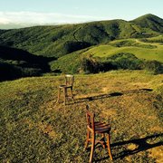
Our breathtaking view once we got to Signal Point was enshrouded in clouds below us, hovering over the Tennessee River 'narrows' and trailing above. It is simply one of the most gorgeous things I have ever seen!
History of Signal Point:
During the Civil War in the Spring of 1863, Confederate forces cut off the telegraph lines to the city. Signal Point became a vantage point for US Army Signal Corp. They used telescopes and binoculars and sat in the trees to more closely view the passage.
The 'Narrows' were a natural highway that extended for several miles downstream toward Paducah, Kentucky. This section was a treacherous stretch of rapids that made it almost impassable for large vessels that were bringing in reinforcements and supplies. The signals, comprising of square flags and torches, signified secret codes that were translated into numbers and words. Their signals flashed over to upriver 'Stringers Ridge'.
Since there is a strong downriver current, the Union Army had to "warpup" the boats along man-made side channels lining the shore and physically pull the boats.
The Union Army was led by Major General William T. Sherman.
Tennessee Valley Authority (TVA) now operates a series of dams to allow navigation along the River.
There is an additional trail in this park, directly to the right of the overlook, past the rock wall and beyond the cross-fencing. This trail is rated a 'strenuous' hike. It leads to Julia Falls, a wet-weather waterfall. Along the way are several notable rock formations, including 'Mushroom Rock' and a suspension bridge that leads to the waterfall. We will be back to tackle that more difficult trail once the leaves turn, which should be very soon.
I would label this trek to the Point as 'Easy'', but keep in mind that rainy days will make the stairs slippery and a bit more difficult as there are no handrails. Wear hiking boots and bring a backpack with snacks and water!
After we had our fill of fresh air, serene quiet and cool breezes, we made our ascent back. Once we were halfway back we discovered a dirt path leading directly to the parking. We decided to take that path and avoid the slippery stairs. A smart decision.