Chiricahua National Monument

Park · Cochise County

Chiricahua National Monument

Park · Cochise County

1

12856 East Rhyolite Creek Road, Willcox, AZ 85643

Photos

Chiricahua National Monument by null
Chiricahua National Monument by MATADOR_NETWORK
Chiricahua National Monument by null

Highlights

Chiricahua National Monument is a stunning 12,000-acre haven of mystical rock formations, breathtaking vistas, and diverse hiking trails, perfect for outdoor enthusiasts.  

Placeholder
Placeholder

12856 East Rhyolite Creek Road, Willcox, AZ 85643 Get directions

nps.gov
@chiricahuanps

Information

Static Map

12856 East Rhyolite Creek Road, Willcox, AZ 85643 Get directions

+1 520 824 3560
nps.gov
@chiricahuanps

Features

wheelchair accessible parking lot
wheelchair accessible entrance
parking private lot
parking bike
crowd family friendly

Last updated

Jul 14, 2025

Powered By

You might also like

Terms of Use • Privacy Policy • Cookie Policy
 © 2025 Postcard Technologies, Inc.
@matadornetwork

"The Chiricahua area is one of the most remote and spectacular in Southern Arizona. It’s known as a “wonderland of rocks” for its dramatic rock pillars, which rise hundreds of feet in the air, balancing on a narrow base, and seem on the verge of toppling at any moment. A stop at the visitor center offers a good introduction to the geology and history of the mountains, and an eight-mile scenic drive provides opportunity for the visitors to see this unique ecosystem. Along the road, viewpoints and trailheads have scenic views and hikes showcasing beautiful vistas that change around each bend. But the natural environment is not the only draw of the area. The place also has a historical significance as it was the sadly stage of the 24-year-long Apache Wars, a bloody conflict between the US Army and several Apaches nations." - MATADOR_NETWORK

Day Trips in Phoenix
View Postcard for Chiricahua National Monument

Tre “Nerdy Traveler” Heitman

Google
Amazing park i never knew existed! Very beautiful and peaceful. There is an amazing almost 10mile hike with campgrounds that definitely warrent a camp trip. Also, shorter trails up on top where the views are most excellent! We plan to come back for sure, but we were just driving through. Even if you only have an hour or so to spare, there is a very scenic drive you can take to the top that's well worth the visit. Also, the NP agent inside was super nice and informative. Great park!

Mihai S

Google
Great experience regarding the walk for the monuments! We took The Big Loop even though we were not quite prepared physically. Reading a lot on the internet about and being determined to squeeze the max out of it, we started the trail at 8 o'clock in the morning. We finished at 3 o'clock in the afternoon. Many thanks to the administration for keeping such great shape trails. Clean pathways thanks also to the educated tourists! We would gladly return!

Jenevieve Hornsby

Google
Very beautiful location such a neat ecosystem after coming from Tucson. Very windy when we were there but lots of hiking trails and vistas to explore. We loved the grottos with our little ones, great rocks to climb.

Zackary Beckham

Google
Beautiful national monument with 9700 acres of pristine wilderness. There are many great hiking trails, that interest and weave through the park. All of the trails have good signage. Camping space is limited, so plan ahead. Parking can also be tight here, so plan a backup trail in case the one you want is full. The park is free to enter and does not require advanced tickets or reservations.

Andie Morgan

Google
What a wonderful surprise. Incredible formations and miles of beautiful hiking trails. Pack a lunch and plenty of snacks and water. There are bottle fill stations as well. The visitors center has great information, maps, helpful staff, scheduled ranger programs, interactive displays and a nice video. Some trail snacks are also available.

Preston Anway

Google
Arrived just after the visitors center closed, but grabbed a map (accessible just outside the center) and got to the top of massai point. There’s a small building there that shares history/general information plus great 360 views. The echo canyon loop has incredible views before sunset.

Robert Wilson

Google
The Chiricahuas are absolutely phenomenal. Growing up my dad would take us camping and backpacking on the southern end. This year I took my partner to the monument and we hiked the 8 mile big loop. One of the best hikes of my life. Naturally cool and windy

Steve

Google
The views are spectacular. Chiricahua National Monument is located in southeastern Arizona and is known for its stunning rock formations called “hoodoos,” which are tall, thin spires of volcanic rock. These formations were created by a volcanic eruption millions of years ago. The monument is often called a “wonderland of rocks” and offers scenic drives, hiking trails, and rich wildlife. It was also the homeland of the Chiricahua Apache people, including leaders like Cochise and Geronimo. Today, it’s a peaceful place where visitors can explore nature and learn about the area’s natural and cultural history.

Tom H.

Yelp
Go here. Fill up your gas tank first, and bring along some food and beverage. Get your cameras ready; you'll seen fantastic landscape, mountainside, rock formations, and views rarely paralleled. There is a visitor center, but no other services (yes, handicap-accessible restrooms). You'll go very slowly up one of several VERY LONG GRADES. At convenient points, there are lookouts, including the very top. There are several trails. Occasionally, there is cell service. Leave No Trace is the policy; you'll see why. It's pristine, and has amazing rock formations, and an interesting history. Yes, it's a drive, and yes, the nearest gas/diesel is 40mi away-- one way. Plan your trip and you'll have great fun. The vistas are inspiring.

Michelle R.

Yelp
This is my favorite national monument by far! It's truly otherworldly - I've never seen anything like it. In some ways, it's even more impressive than the Grand Canyon. It's also AZ's best kept secret which means no crowds. It is more primitive than a national park. There is running water at the visitor center and a handful of snacks. However, no real food or drink available. It's about 30 miles to the nearest restaurant - so it's a bring your own food and water type of trip. There is virtually no cell reception in our surrounding the monument. This means that you need to know directions to get there and for leaving as you will not have reception to map your way in/out for a few miles. We hiked the Echo Canyon Loop. This hike is appropriately rated moderate and is 3.2 miles with a 557ft gain. Going counter clockwise is a must. You hike steeply into the canyon through the hoodoos and grottos. It feels like an alien planet. Once you've reached the bottom, the ascent is not as steep. It takes most people 1.5 hours, but we took our time and completed it in 2 hours and 45 minutes. This is my new favorite hike and I can't wait to go back!!

Jennifer S.

Yelp
Amazing hidden gem in Arizona! Lots of great hikes to choose from. The weather in the Southwest is fantastic at this national monument.

Robin S.

Yelp
National Parks and Monuments invariably garner five stars from me. Chiricahua is no exception. - Wonderful park full of hoodoos. Very cool. - Nice visitor center. - If you're not able to hike, there's a good road taking you to the top where you'll be afforded great views of the park and surrounding area.

Wen C.

Yelp
Chiricahua National Monument is a hidden gem as it is absolutely gorgeous, but didn't seem to have many visitors. Essentially, there was a volcanic eruption and with time and erosion, there are many cool-looking natural rock spires and formations. The Echo Canyon Loop (3.2mi) allows you to get up close and personal with the spires. It took us 1.5 hrs to hike this. If you go counter-clockwise you see the spires first, and then go to the less scenic area at the end to the parking lot. There was a fair amount of shade, but make sure to bring water! Massai Point Overlook is an area that you can drive to, park, and look around without much hiking needed. There is a small trail to an elevated area and covered shelter with some exhibits, but the view from the parking lot is plenty. The visitor center gives more information about the natural features of the area as well as the fauna and flora.

Ed T.

Yelp
This review is for Echo Canyon Loop which was a ~3.2 miles round trip that took ~2 hours to complete. Extremely cold and windy! Rocky with some inclines. Stunning rock formations from beginning to end! Short video of the hike for those interested! https://youtu.be/EwHjPu2PLpw

Travis T.

Yelp
I can't believe this place exists in Arizona. What a cool hidden gem! Chiricahua National Monument is located around 30 miles southeast of Willcox. The whole area is a result of a volcanic eruption that happened millions of years ago. Chiricahua is known for its many stone columns called hoodoos. A hoodoo is a tall, thin spire of rock formed by erosion. These are the same rock formations that you see in Bryce Canyon Park in Utah. Once you enter the monument and pass the visitor center, the main road is about an 8 mile drive and ends at Massai Point. Along this scenic drive are many pullouts you can stop at and a number of hiking trails. I highly suggest grabbing a paper map at the visitor center as there is hardly any Wi-Fi in the area. I also suggest driving all the way to Massai Point. The views are amazing and worth the drive over. If you want to camp, Bonita Canyon Campground is near the entrance. It has 25 sites. For hiking, there are some easy nature trails near the visitor center. I did the Echo Canyon Trailhead at Massai Point. The hike itself is easy to moderate and the views are incredible. If you want to do more longer and difficult hikes, the Ed Riggs / Mushroom Rock / Balanced Rock trails to either Inspiration Point or Heart of Rocks is a good one. Or do Lower Rhyolite Canyon / Sarah Deming trails to Heart of Rocks from the visitor center. Both will get you deep into the canyon and close to some cool rock formations. A bill was just recently passed to make Chiricahua Arizona's fourth National Park.

Keith C.

Yelp
This is one of my favorite places in the world. The sights are breathtaking. The hiking is fantastic. If you get a chance, ride the bus to the top and hike back down to the visitor center. The best thing about Chiricahua is that there are no crowds. The staff is super friendly too.

Amanda A.

Yelp
Arizona's best kept secret! Came here on a Monday morning. Hiked for 5 1/2 hours and only saw 3 other people the whole time. This place has stunning views, lots of wildlife, and is very peaceful. We started at the echo canyon parking, went down Ed Riggs trail to mushroom rock trail, inspiration point, big balanced rock, heart of loops and then back the same way to the car. The entire hike was about 8 miles. There are bathrooms at the trailheads throughout the park. The trails are well maintained and obvious where the trail is. The trails are also well marked although I don't think the miles listed on them are super accurate (unless my phone isn't). A little out of the way, but definitely worth the drive!

Paul L.

Yelp
I arrived early in the morning and there was no one there. It was a quiet drive to the end of the curvy road that takes you to the top of Chiricahua for a dramatic view of the organ pipe rock formations. At this time of year, turkey vultures fly in groups overhead looking down for the next meal. Fortunately, Chiricahua still doesn't seem to have been ruined by Instagram crowds. I'm sure it's just a matter of time. For now, enjoy.

Sharon B.

Yelp
This should be a National Park and I think it's being considered. Outstanding rock formations, gorgeous camping, a big WOW!

Maxine P.

Yelp
One of my favorite places to hike. Breath taking views at every corner. Enter a world that could be used as a back drop for a Starwars film with all the amazing Hoodoos and rock formations. We hiked 9 miles including the Heart of rocks Trail. Make sure to do the short loop at the top which takes you through the hoodoos. Recommend walking poles, extra water on this hike. Also it does reach elevations of more than 7000 feet with a number of steps up and down. We drove in from Tucson and well worth the drive.

Beth B.

Yelp
Omg if you haven't been you need to visit. The rocks are just crazy and the views. Wow Echo Grotto and Masi point don't disappoint. Well worth the drive. Go visit

Mark A.

Yelp
I'd seen pictures of Chiricahua National Monument (NM) and it always looked so cool. Those store pillars - or were they piles of stones - reaching up across the valley just seemed totally cool and unique. Im not aware of anything like this anywhere else in the world. On a recent trip, I finally got to visit Chiricahua NM. Its a small park, but it has what looked to us midwesterners like good size mountains and then of course all the rocks. We drove to Massai Point and took in the view there. Very cool view of the valley and the rock formations. Then, we went to Echo Canyon and I hiked as far as Echo Park. It was a very enjoyable hike that took me down into the canyon. If I'd had more time, I would have happily done the loop of the Echo Canyon/Hailstone/Ed Riggs Trails. Overall though, Im just glad I finally made it here, as it was as cool as I'd hoped it would be. Its in an isolated part of southeastern Arizona, but if you've come this far to this part of the country, its probably worth it to check out Chiricahua NM. Now if only I could remember the name of this place and how to pronounce it.

Melissa M.

Yelp
Return trip. Same as last time- bring snacks! Hiking in winter, bring lots of layers, that wind will get you :)

Nancy S.

Yelp
We love this monument! There are so many hiking trails for all levels. The views are incredible!! There is a wonderful visitors center and so many points of interest! We love coming here and highly recommend it to all of our friends!!

Craig S.

Yelp
This place has the coolest natural rock formations I've ever seen in person. I took the echo canyon loop that was about three and a half miles. Unfortunately, I only had the afternoon and couldn't stay longer, but this place has tons of trails that I would imagine are just as cool Remember to bring some sunscreen, some water, and a camera for all the great views. You know that it's going to be your new profile pic! I also wouldn't expect to make any personal time records hiking here since you spend so much time looking around in awe. I would definitely plan on my next trip here for 2 days at a minimum and look into camping and the organ pipe trails.

Michelle L.

Yelp
This is a must see if you're in the Tucson area. It's definitely worth the drive! The rock formations can only be described as other worldly. Was very impressed with the well marked hiking trails. Also enjoyed that the trails weren't packed, even on a weekend. Would definitely recommend going in either the spring or the fall because I imagine it gets really hot in the summertime. Mid March was perfect!

Krissy L.

Yelp
What a beautiful hidden jewel! Spectacular scenery and views. When you first drive in at bottom of canyon there are pretty trees and close magnificent rock formations called Organ Pipe and Sea Captain. Continue on and up the mountain for a few more miles and see the unbelievable sights of Gods art at Sugar Loaf and Maasai Point!

Steve S.

Yelp
This is one impressive beautiful park. We hiked the Echo canyon, the Hailstone and the Ed Riggs trails today. The Rhyolite stone formations are like none I've ever seen and it's certainly work taking the time to hike about and see them. The Rhyolite stone is from volcanic activity millions of years ago then carved over time by weathering. Not only will I be back, we plan to do more hiking here tomorrow.

Laurie A.

Yelp
You don't realize the beauty and how breathtaking this area is from the outside of it. The more you drive in, the more you see the grandiosity of the area. We did everything in one day. Lots of picnic areas. Lots of hiking.

Jeffrey S.

Yelp
Where have I been my entire life? How have I lived in the neighboring state to the north, known plenty of Arizona citizens, been a huge fan of the National Park System, and never once before this trip heard of Chiricahua? I'm supposed to be an outdoorsy kind of guy. I'm supposed to know this stuff. Yet there I was, in a restaurant, and the waiter was telling us we should go there. And then after hearing the name, the next day I learn that it's actually a national monument. I can only say that it's an embarrassment that it took this long to discover it. On the other hand, though, I can very honestly say that I had no expectations going in. I mean, I had no idea what it was known for. It could have been a volcano, an arch, cave, or giant hole in the ground, and I would have been equally surprised. So what is it known for and why is it a national monument? Best I tell you through story: 
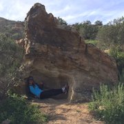
I had just spent the night in Organ Pipe Cactus National Monument and decided, upon the advice of that friendly waiter, to check out Chiricahua next. Our day had gotten away from us a little and we rolled into Willcox a little after dark. We made the turn south on the 186 in total darkness, the kind that fires up your imagination with what might be outside of either window. Canyon walls? Flat fields of cactus? Too dark to know. We followed the signs and turned up the road into the monument, entered the trees, found the campground, turned in, and shined headlights on our site while we set up tents. We knew there were trees, we knew it smelled damper than the dry desert, and we slept. In the morning, I was last to wake up. I heard excited noises and an invitation to get out of my tent and see the "Bryce Canyon" like place. I put on my shoes, wiggled out of the tent, and had to adjust my eyes. Indeed, we were covered in trees, but through them the morning sun had set the canyon wall ablaze with color. Rock pillars and sheer canyon sheets plunged down and disappeared into the treeline. After the kind staff at the visitor's center gave us all the hiking info and maps we'd need, we drove the rest of the way into the park, climbing to the tippy top of the Massai Point Overlook. And there's why you see what this place is all about and why it's a national monument. It's a massive canyon of rocks; a series of walls with foothill hoodoos and rock formations, like little gray, green, and orange soldiers lined up amongst the trees. It had been raining, so the lichen was vibrant and the colors deep and contours in high contrast. The big, white, puffy clouds were pushed by a pleasant but brisk breeze. It's a garden of rock gnomes, some several stories high. Skinny spires and squatty blocks that excite the imagination and beg to be explored. We set off from Massai Point, down the Ed Riggs Trail, then at the sign, hit the switchback down to the river on the Mushroom Rock Trail. The namesake formation is well-marked. From there, we continued into Hunt Canyon and finally started to ascend. We skipped the Inspiration Point spur, but continued on the Big Balance Rock Trail towards the Heart Of Rocks Loop. About the time you get to Big Balanced Rock, your head is going to explode. You've just walked along a lovely forest stream, then risen to an exposed landscape with amazing views, and then entered the rock wonderland. The loop has lots of named formations, but the most breathtaking part for me was the northwestern corner where the view opens up to a whole other section (Hailstone/Echo Canyon Trails, a separate trailhead) and you see just how vast an area the formations span. I could go on about the hike, for sure. The campground is an instant classic. Clean restrooms, safe boxes for your food, ample water sources, and inexpensive. Each site has a BBQ stand, picnic table, a pad with enough room for a few small tents, or one large one. It's covered with shade, which probably comes in mighty handy in summer. Sites can be reserved ahead of time, but in our mid-week, offseason trip there were plenty of openings for walkup. Watch out for Mexican Jays; their natural tendency to scavenge for pickings from predators has morphed into an army that appears when wrappers start crinkling. And there are skunks. We saw them. It's a special place. It merits more exploration. And if you're touring around Arizona, it's unlike anything else. It's not Saguaro, it's not the Grand Canyon, it's not Organ Pipe. It's a unique, beautiful, magic place. I may not have heard of it before, but surely now I'll never be able to forget it.

Yuko H.

Yelp
Rock wonderland! Chiricahua national monument is a part of national park service but not admission fees, free to enter! They have several different trails, perfect for different fitness level. I did Echo Canyon trail on the day I visited. It was about 2-3 hours, just perfect as a first time visitor. I carried just two bottles of small water, one energy bar, that was enough for three hours of nice trail walk. There are a lot of photo opps along the way, I took time taking pictures and enjoyed the amazing rock formations. I would love to come back when I am more prepared and go check out the balancing rock. It would be about 6-7 hours of hike, but from a picture I saw, this place will go on my bucket list. Staff at the visitor center was very friendly, kindly took time to explain about different trails and some view points. Nice gift shops, I purchased my magnet to add to my collection for my fridge at home. There are several view points accessible by cars, suitable for any fitness levels, highly recommend visiting this rock wonderland. Cheers to the beautiful earth!

Daniel K.

Yelp
Beautiful NPS site. Drive through park has amazing scenery. Lots of wildlife throughout. Good junior ranger program. Campground is well maintained. Definitely ranks up there in 'wow factor' with some national parks. Definitely worth checking out.

Royce K.

Yelp
Been wanting to come here for years finally I decided to go And it was a great experience Weather's perfect today and all these rock formation they're really cool never knew we had such a big Volcano so close to us Pretty easy hiking around no real steep inclines I think the total loop was 5 miles And they have a few other ones that when a have time to get to but definitely will try again only bad thing was I didn't really see any wildlife though It definitely said being must stop if you're not too far from here

Loren A.

Yelp
Wowwwww. This is known as the Wonderland of Rocks! If you live in Tucson, this national monument park is practically in your back yard. Just shy of 2 hours of driving, you hit Wilcox then go south, then boom! You see all those incredible rocks! Campsites are so nice and the bathrooms are clean AF. Go up to the Echo Canyon and go down on Massai Point trail. It's a 4 mile loop hike. You'll get to see the BEST parts in the end of the loop which are the Grottos! Be sure to bring plenty of water and lunch with you as you stop half way and take in the scenic views! The trail is easy to follow! Other friends asked me if I could take them down to see it-- I would do it over and over because this place will continue to revitalize my soul every time!

Karen M.

Yelp
Amazing. This park is a hidden jewel tucked away in Arizona's SE corner. My husband and I spent the last weekend of 2017 camping and hiking here and I think we may have established an annual tradition! We stayed in the Bonita campground for 2 nights and were amused by the numerous Mexican blue jays who brazenly demanded food. We also saw a deer calmly walking by our campsite as well as a skunk foraging for food. The campground is really clean and features flush toilets and potable water. The fee is $20/night. As for the actual landscape....Chiricahua is a rock wonderland. You see unique rock formations every way you turn. We did 2 hikes: the "Natural Bridge" trail (5 miles round trip) and the "Big Loop" (9.5 miles round trip). Both hikes had their own unique environments and beauty; if you are limited for time, I recommend doing the Echo Canyon loop because it has the most awesome rock formations "bang for the buck." However, the better thing to do is to spend as much time as you can here to soak in the ethereal, otherworldly beauty. The park was not busy this past weekend, even though the park ranger said it was a "busier than normal" weekend (he based his answer on the almost 400 visitors who came on the weekend). I think the remoteness of the park deters most people, if they even know about it! Go and restore your soul. So worth it!

Eric B.

Yelp
You've seen the photos. You've wondered how the heck that balancing rock stays balanced. You've noticed how far away it is from civilization... If that's not enough to convince you to head out to Chiricahua, I don't know what is. Being able to witness it firsthand will leave you absolutely awestruck! I did the Heart of Rocks loop hike, a fairly easy 7-mi roundtrip hike that takes you up to the amazing rock formations and provides plenty of opportunities for some great photos. There are so many smaller boulders on which you can climb and get some excellent shots of the scenery. Just be careful getting up/down and don't try something unless you know you can handle it! Overall, give yourself about 5 hours to complete this hike. You may be laughing now, but after stopping for snacks/photos multiple spots along the way, you'll see the time easily adds up. Get out into nature and explore the land where the laws of physics rarely apply!

Jenni K.

Yelp
Stunning views! I'm not an avid hiker, so I was a little intimidated to do a 7 mile trial, Rhyolite, but I survived and it was so worthwhile! We went in mid June and it was a little rainy. The cloud coverage, patches of sunlight, light humidity and breeze made it enjoyable. The weather was perfect. It took us exactly 4 hours to do the whole trail (the ranger and signage estimates 4-7 hours) starting at the monument building. It was awesome to view the various rock formations. I liked the camel's head, Thor's hammer, and kissing rocks :) Make sure to bring plenty of water and salty snacks.

Jim S.

Yelp
Now this stop is the bomb! I had this on a bucket list for a while. We stopped and hit the Willcox wine scene first, which is about 35 minutes away from the park. It is amazing! The rock formations are more interesting and beautiful than Sedona. The drive through Bonita Canyon is about 6 miles and climbs steeply in elevation. It is super scenic from the bottom to the top. There are over 2500 species of birds and unique wildlife in abundance. We saw three Mule Deer upon entering the park. The visitors center is beautiful and lends to you a full history of the area. It serves as a gift shop as well. May I say that this is one of the most scenic and magnificent places I have ever seen. Carved by volcanic activity, it is no wonder they made this into a preserve. The drive out meanders through stunning mountain passes and wild flowers. Small towns dot the landscape here and there. It makes you understand why the Native Americans chose this region. If you heading down south, take a detour and enjoy the beauty that abounds. #irishcatv2 #vinosquared #vino2 #vino2ultimate #twylytephotography #willcox #chiricahua

Lisa M.

Yelp
Beautiful park. Rob had never been here before. We hiked the Grotto trail. Fabulous! The views are amazing. Photos don't do it justice. Very well maintained trails. Kids could walk in the trails with ease. Still recommend appropriate hiking shoes. I will go back here every time I'm in the area.

Risa D.

Yelp
First of all, the National Parks and National Monuments and Rangers are what makes America Great, they tell a story of a nation that fights to protect the earth and it's diversity, and they tell their millions of visitors facts (not alternative ones, actual ones - and if you haven't read the statement by their former director than you absolutely should: https://www.facebook.com/parkrangers/photos/a.453853098428.247613.92474223428/10154671974088429/?type=3&theater ) to protect us from the dangers of forgetting history. Anyway, I'm emotional today and to be honest most days about the thunderous beauty of the world and how delicate it is and how lucky we are that parks (and rangers) exist both to protect and share it. Chiricahua wasn't even on our radar. We heard about it from a waiter at an awesome brunch spot (review to come, I see you Welcome Diner!) and so after camping out in Cactus Pipe (I'll review this too!) we drove through the desert and into the night to set up camp here. We set up in the dark and had no idea what we were in for. The campground spaces are awesome, you are in green woods surrounded by cliff walls that light up in the sun. There are trees between the spacious sites and, in January anyway, it's cool and there are lots of spots to choose from. The bathrooms are clean and have running water. There are fat sarcastic "Mexican Bluejays" who come visit when you make distinctive food prep sounds, but then pretend to act all casual. There are blind skunks with puffy white tails bumbling about at night who bolt off awkwardly when they hear you. The women at the visitor center opened a few minutes early for us and laughed with us and enjoyed our eagerness. They gave us good advice on driving and hiking for the day, and wondered with us at the magical mystery green smell haunting the valley. Something about recovering from wildfires maybe. Anyway, the actual best smell ever. We did the Big Loop hike from Massai Point. When we drove up to the starting point our jaws dropped. A canyon full of insane rock structures, wildly balanced on each other, enormous but delicate, glowing with new green moss, a gold halo in the distance from the sulfur flats. Completely magic. Like the green grey soulmate of Bryce Canyon in Utah, if that makes sense... and if it does, because you've got to witness both these places, than you and I are equally blessed and I wish we could share this epic resonance with every sad, needy, greedy soul out there who needs a little perspective.

Lori G.

Yelp
Oh yeah! Beautiful, well cared for, a little chilly in the afternoon. Would definitely return some time maybe in the summer to camp overnight.

Mia N.

Yelp
A friend and I hiked the major loop around Chiricahua this past weekend. We also did the smaller loop inside the park (I think it was called the Heart of Rocks trail?), so altogether it was about 10 miles. We started at noon and finished around 6:30, taking many rests and picture breaks in between. Surprisingly, we encountered very few other people on the trail! We parked our car at Massai Point and there were quite a few people there and even a whole class on a field trip, but once we started out on the trail I would say we only encountered ten other people. It was really nice to feel so remote and alone in the wilderness. As luck would have it, we happened to hike through the grotto at sunset. It was beautiful and amazing! I only wish we had seen some wildlife. All we saw were some Mexican blue jays. I'm not in the greatest shape (max I can run is like 1.75 miles without wanting to die) and I didn't think the hike was all that difficult. The hardest bit was a half mile ascent up the canyon on the Echo Loop Trail. if you can make it up Camelback in Phoenix, you can do this hike with no problem. The camping facilities were nice and pretty much what you would expect. The campgrounds do have flushing toilets, a sink, hand dryer, and mirror in the bathroom. No complaints about anything except for some campers in nearby campsites who made a LOT of noise when they woke up at 5 am. Camping is $12/night. Park entrance fees are $5/person. If you like camping, you have to make a trip out here some time! Oh! one recommendation for a stop (which I'm not sure is entirely legal) is that on the drive into the park we passed a small cemetery on the 186 about 5-10 miles outside the park entrance. on our way home, my friend and I decided to stop in to take a look, even though it said "Private Property No Trespassing" the gate was open and we only stopped in for 5 min. anyway, it turned out to be the Riggs family cemetery (from which the Edward Riggs Trail is named). it was very cool to see Ed Riggs's tombstone and to read the inscription.

Brad H.

Yelp
A beautiful and inspiring place to hike and take in nature's beauty. It is so helpful of the park service to have great information on available hikes and their difficulty levels and distances. We chose the Echo Canyon Trail which took us through most of the great formations. It is incredible that these are just pillars or piles of rock. How come they do not just topple over? Amazing. I do not know if this was typical, but when we went, the second weekend of October, there were hardly any people there. Just the quiet of nature was our companion. The weather was great, too, as we had cloud cover all day and enjoyed not burning up. What a beautiful park. And facilities are well kept and maintained. The trail we took was clear. The visitor's center was informative enough and had nice restrooms and water facilities. At the head of the trail were non-stinky bathrooms. Really, if you enjoy hiking and the out of doors and taking in beautiful scenery, you must come here. It is really one of Arizona's gems. It is only a 90 minute drive from Tucson. And there is a great place to eat in Willcox. (Isabella's South of the Border, see my review) On this trail, no dogs were allowed. I do not know without referring to their website if the other trails also do not allow dogs. You will want to take water as with any hike. And definitely your camera of choice. 5* = A top favorite. Mind-blowing good. I will definitely return and I will go out of my way to go here. Worth every dime of my money. 4* = Outstanding. Tucson-top-tier. Some elements not quite as good as it gets, but it still is worthy of my regular business. 3* = Good experience. I might do repeat business if it is convenient, the only option, the only one in its category, or on a whim, but would not be among the first thing to come to mind. Would definitely recommend you trying it to get your own take on it. 2* = Not so good. Would not recommend at all. Waste of money. 1* = How are they still in business? Stay away at all costs!

Ed M.

Yelp
Hide gem of Arizona! A must do if you like to hike and see the wonders that have been created. Spring and fall may be to warm in summer

John C.

Yelp
Awesome. Amazing. Breathtaking. Magnificent. Insert any adjective you want. I first visited this park in 1996 and most recently is 2017. Both times I was taken aback by the beauty and awe of this natural landscape. It is really a sight to be seen in person as pictures and words do not do it justice. I think the trail system here is very well maintained and its a fantastic place to hike. I kept finding myself staring straight up in amazement at the Rhyolite columns extending to the heavens. I also thought about the Apaches who called this amazing place home. What a great treat in a beautiful part of the state. The Chiricahua National Monument is located in the Chihuahuan desert and it can be very windy and extremely cold here in the winter. If you are into camping there is a tent area when you first enter the park.

Susan P.

Yelp
Wow! So glad we finally got to visit Chiricahua National Monument. We hiked the Echo Canyon trail which was almost four miles of amazing views. The trail was clearly marked and the views were astounding. After the hike, we stopped at the visitors' center which had fun souvenirs. Restrooms were clean and hand sanitizer was readily available.

Lisa C.

Yelp
Magnificent sights. Breathtaking views. Hiking is out of this world. Wildlife abounds. Staff at Visitor Center top notch!

Monish S.

Yelp
great drive , little out of the way but just rustic and romantic place . The rocks just look amazing . Only did the drive to Massai point and back with lots of pictures on the way. Deer , rabit , beauiful birds - its a nice forest. The restrooms are very clean and the place is worth going for a day trip . I plan to go again.

M.C. S.

Yelp
VERY BIG LOOP HIKE DESCRIPTION Yesterday, I hiked the "Very" Big Loop at Chiricahua National Monument (12.5 miles). I started my hike from the Visitors' Center and hiked up the Lower Rhyolite Canyon Trail. It is also possible to begin the "regular" Big Loop at either the Echo Canyon or Massai Point Trailheads, but if you do that you will miss the Lower Rhyolite (for a loop of 9.5 miles), plus you will go downhill first and uphill second, which most hikers (me included) simply despise. I thought this section was a nice warm up - the first bit flat through the trees, and then up along the canyon wall with nice views across to some hoodoos. If you have the time and fitness, I recommend starting your hike at the Visitors' Center. After 1.5 miles, I came to a junction, and went right on the somewhat steep uphill Sarah Deming Trail (1.6 miles). Hiking the loop counterclockwise is recommended as it makes for easier elevation changes. I have read some trip reports saying that this section of the trail is a "slog", but I liked it. Much of this section goes through a forested canyon that on my December hike even had some spots of snow - maybe not spectacular if you are from elsewhere in the world, but for Arizona residents it is certainly novel scenery. From the Sarah Deming Trail, I did a 1.1 mile loop around the Heart of Rocks. This was one of the highlights of the hike with some easy scrambling and many cool rock formations with imaginative names (posted on signs in front of the formations). I won't ruin the surprise - it is fun to discover the formations and names yourself. After the Heart of Rocks, I did the 1.0 mile Balanced Rock Trail (unspectacular other than its namesake feature) and then a 1.0 mile out-and-back to windy Inspiration Point where I took a long snack break. The view from the point gives you an excellent perspective on why Chiricahua is called a "Sky Island". After that, it was on to the unremarkable Mushroom Rock Trail (1.2 miles) and down into Hunt Canyon and more shady forest - a welcome respite after some sunny sections earlier. Then at a junction, up the exposed Ed Riggs Trail (0.9 miles). This trail has some more nice views of the rock formations, but it is a bit tiring since it's uphill and, at least for me, warm since I got here in the middle of the day (even though the high was only 60, it's still hot in the sun when you're working hard!). I skipped the side trip to Massai Point in favor of returning via car for sunset (which is highly recommended - even though I was tired from my Very Big Loop I did the nature trail at Massai Point twice as evening light illuminated the hoodoos). So, I hiked directly to Echo Canyon parking area and had lunch at the picnic table there. Even though this part of the hike is road accessible, I saw no other people - indeed, I saw just one other person the entire day until I got back to the Visitors' Center, which was comparatively "crowded" with three people! Anyway, from Echo Canyon parking lot, I descended down the Echo Canyon Trail (1.6 miles). This part was certainly the highlight of the hike. The top section has excellent views of the hoodoos reminiscent of Bryce Canyon or Pinnacles, while the middle section goes through areas called "The Grottoes" and "Wall Street" with some amazing red rock formations that are straight out of Zion. After savoring the Echo Canyon Trail (it took me two hours to travel the 1.6 miles due to all the stops!), I arrived at the Upper Rhyolite Canyon Trail (1.1 miles), which has some views of hoodoos in the distance but primarily goes through another wooded canyon. Finally, I arrived back at the top of the Lower Rhyolite Canyon Trail and coasted the remaining easy 1.5 downhill miles back to my car. After checking out the small Visitors' Center, I drove the scenic Bonita Canyon Drive up to Massai Point for a glorious sunset. SUMMARY Wonderful hike with beautiful, varied scenery. No crowds. Extremely well marked/signed and well maintained trails. Be careful of the weather (heat in summer, snow in winter) and the elevation (ranges from about 5400 to almost 7000 feet). I started my hike at 8 am and got back to my car at 3:15 pm, so a bit over 7 hours of hiking including stops for breaks, lunch, pictures, etc. In all, I would say this is among my favorite day hikes I've ever done (and I've done a lot). OTHER HIKING OPTIONS I hiked a 12.5 mile loop with probably close to 2000 feet of cumulative elevation change, which I realize is a lot for many people. As mentioned above, you can do the "regular" Big Loop of only 9.5 miles that not only cuts down on distance but also elevation gain. Or for an even easier hike, you can take the hikers' shuttle that departs every morning from the Visitors' Center to Massai Point, then hike back to your car via Echo Canyon (about 5 miles, all downhill) - though by doing this you would miss the Heart of Rocks. ENJOY!

Chad W.

Yelp
Even though I was born and raised in Arizona, I had never really heard anything about Chiricahua National Monument. In fact, I only ended up visiting this park by chance (thank you Google Maps). Admittedly, it's a little out of the way, but the extra 70 miles roundtrip were completely worth it. The drive to the park was beautiful and solitary - you drive through some old wine country valleys and along the base of the mountains of Chiricahua park. There's a small visitors center a few miles past the entrance gate of the park, where you can get a map and the rangers will help you decide what you have time to see during the day. I decided to go all the way to the top - Massai Point to see the overlay of the park. It was fantastic. You could see so many different rock features from the top of the overlook. After I had followed the nature trail around the area for an hour or so and took some pictures of some of the rock formations, I decided to head back towards the main entrance to see the Echo Canyon Grotto. After hiking about 15 minutes down the Echo Canyon trail, I found the Grotto, took some pictures, and began to head back out of the park. Even though the park isn't that large, the road along the mountainside is fantastic and the views are truly spectacular. It's interesting to see how the rain and wind has eroded the mountains to form beautiful (sometimes unbelievable) columns. If you have not been here, but want something outdoorsy to do along the I-10, this is the spot that you need to check out.

S H.

Yelp
Beautiful place to go and explore! The entrance is free and dogs are allowed on a few trails. The drive is so nice we were able to see some wildlife and the staff in the visitors center was so helpful and friendly. Wish we could have spent longer here. Peaceful and relaxing!

Norie J.

Yelp
It's about a 2hr drive from Ft. Hauchuca but worth it. Went hiking yesterday 5/18/16 and as luck would have it we had a partly cloudy day .. Temps ranged mid 60s-low 70s. There is no longer an attendant at the entrance gate as they no longer charge for admission to the park (camping fees are different..) There are clean restrooms near the visitors center and a water fountain with bottle refill station. Plenty of parking (when we arrived at 945am only 3 other cars were there) We parked at the visitor center ( open from 830a-430p) and checked for any closures and picked up a map.. There was some road closures due to repaving of the road on the scenic drive however that did not affect us as we decided to hike. We started off at lower Ryolite to Sarah Deming and continued onto the Heart of Rocks loop , back to Big Balanced rock and Inspiration Point.. Then went back out to the visitors center .. This was 10.5 miles completed in 5.5 hrs going at a pace of about 30 mins a mile.. With taking pictures along the way. Stops for water and to have lunch at Inspiration point. The trails were maintained , some sections of loose rocks, stairs , "climbing" rocks vs a dirt trail .. There are plenty of markers along the way so you shouldn't get lost. Saw a snake on the way back on the Sarah Deming trail.. it was either a Sonoran king snake or Milksnake according to the park ranger .. Hard to tell since we didn't see the head. Saw a lot of lizards and birds along the way like the Mexican Jays. Portions of the lower Ryolite canyon and the Sarah Deming trail offer moderate shade however other trails are mostly exposed with minimal coverage. As you gain elevation it becomes breezy and a bit cool (so if you get cold easily wearing long sleeves or packing a light jacket may be helpful) Make sure to pack enough water for the trail you plan on,snacks or a lunch,sunscreen, a hat, I had a deet free bug bracelet and a fresh pair of socks to change into. I consider it a moderate hike due to length, elevation gain, and some scrambling at Heart of Rocks loop. (If it was warmer out moderate-strenuous just due to the heat factor)

Jerry G.

Yelp
Went here on my travels to hit all the National Parks/Monuments in Arizona. I was pleasantly surprised. The road in the park is good. There are places to pull off to the side and see some of he many rock formations. Once you get past the Organ Pipe Columns keep going up the hill to see more rock formations and hiking trails.

Andrea K.

Yelp
Thank you my friends for taking me here for my second hike :) Out in the middle of absolute nowhere is the Chiricahua National Monument. If you want to see the most beautiful scenery and really get deep into nature, this is the best place to go. We went out to the moderate trails, starting and ending with Echo Canyon Trail. (there were 2 in between) It was so awesome to go somewhere that was so peaceful and get the best exercise I could ever experience. From the mountains, to the rock formations, to the lizards that seemed not to freak me out (they were so pretty!) this was one of the most amazing experiences that I had, nature wise. The people that worked the main gate and the welcome center were very helpful, nice, and accommodating. The only thing I could say that was negative was that we wished that the bus ran more than once during the day so we could have went to areas further out. (If you want to take that, it leaves at 8:30am) Also, do not expect any cell phone service out here. The pictures that are shown here from Paul L give a great insight on what this place looks like. I advise anybody who wants to experience Arizona for what it has to offer to go out to Chiricahua. It was a pleasant surprise.

Eric G.

Yelp
This place is still one of my favorites for parks in AZ. Just beautiful! Being mid-October currently, I'm reminded that this is a fantastic place to go see fall foliage as well. Well worth the drive out to see what we're missing in the Old Pueblo!

Brian G.

Yelp
Awesome rock formations. Well maintained trails. Clean park all around. Utilize the shuttle to the top and hike back to the visitors center! 10/10

Manatee T.

Yelp
I think we would have never come here if we didn't stay in Willcox. Worth to visit. We took Echo Canyon Loop and enjoyed it. Free admission!